
There is a moment on the Skyline Trail, deep inside Beavers Bend State Park, when the pines quiet down and you hear it before you see it: a soft rush of water spilling over mossy stone. Broken Bow is famous for its lake, its cabins, and its towering shortleaf pines, but its waterfalls are the quiet reward for guests willing to lace up their boots and follow the sound.
At Three Creeks Reserve, we live at the edge of this landscape year round, and we have learned that the waterfalls here reward planning. Some are secret cascades locals share by word of mouth. Others are dramatic drops in Arkansas, an easy day trip east into the Ouachita National Forest. All of them look their best after a good soaking rain, which is why our first rule is simple: chase the roar.
This guide walks you through the best waterfalls in and near Broken Bow, Oklahoma, with trail details, seasonal notes, GPS-friendly locations, and the practical tips our concierge team shares with every guest who wants to explore beyond the cabin porch.
The Waterfalls Inside Beavers Bend State Park
Most first-time visitors to Broken Bow have no idea there are real waterfalls tucked inside Beavers Bend State Park. The park spans thousands of forested acres around Broken Bow Lake and the Lower Mountain Fork River, and its named falls sit in shaded hollows and along paddling routes that many day-trippers never see.
Beavers Bend State Park
The park is the anchor for every waterfall trip on this list. If you only have one day and one hike, start here. The visitor center is where we send guests first to pick up a parking permit, ask about current water levels, and confirm which access roads are open after recent rain.
- Rating: 4.8 stars (5,208 Google reviews)
- Address: 4350 OK-259A, Broken Bow, OK 74728
- Hours: Open 24 hours
- Phone: (580) 494-6300
- Category: State park
- What to do first: Stop at the visitor center for a parking permit and trail conditions
Thunderbird Waterfall (Skyline Trail)
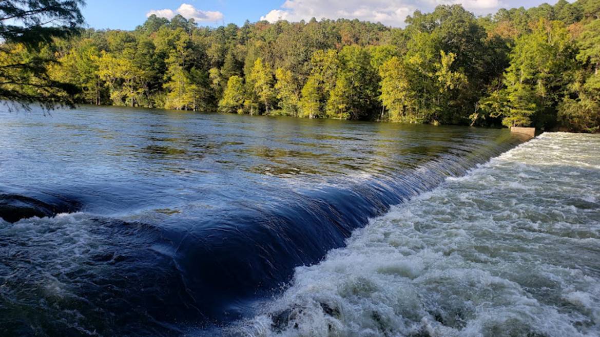
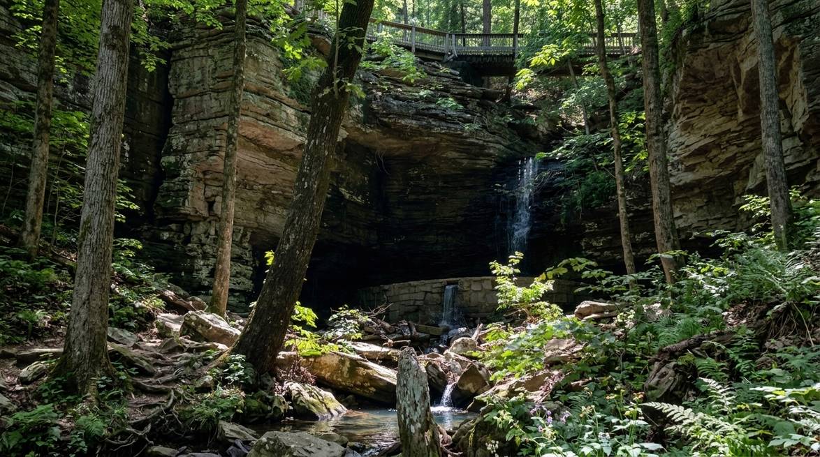
Thunderbird is the crown jewel of the Beavers Bend waterfalls and the one most locals mean when they say “the falls.” It sits in a shaded, mossy hollow roughly midway along the Skyline Trail, above the Lower Mountain Fork River.
You have three ways to reach it, and the right choice depends on your group:
- Full Skyline Trail loop: About 8.6 miles, strenuous, with real elevation, creek crossings, and long remote stretches. Plan a full day and pack accordingly. This is the classic route for serious hikers.
- Cedar Bluff out-and-back: Start at the Cedar Bluff trailhead across from Dogwood Campground, hike about 2 miles on Skyline until you hit a dirt road under the power lines, then walk about 900 feet into the woods to reach the top of the falls. Roughly 4 to 5 miles round trip.
- Boy Scout Road drive-in: Enter Beavers Bend via the south entrance off Highway 259, drive about 2 miles, turn left onto a dirt road, and continue roughly a mile to where the power lines cross. Park and walk 900 feet in. This is the family-friendly option, and the one our concierge suggests for guests traveling with young children or grandparents.
The falls look their best in spring and early summer, especially after a heavy rain. In dry late summer, expect a trickle rather than a roar. If a storm blew through the night before your visit, cancel your other plans and go.
- Best season: Spring and early summer
- Access: Skyline Trail from Cedar Bluff, or Boy Scout Road (dirt, high-clearance recommended)
- Difficulty: Strenuous (full loop) or moderate (shortcut)
- Cell service: Very limited, download maps before you go
Skyline Trailhead
The Skyline Trailhead itself deserves a mention because it is where most Thunderbird-bound hikers start, and because its Google reviews are refreshingly honest about the effort involved.
- Rating: 4.8 stars (48 Google reviews)
- Address: Beavers Bend Rd, Broken Bow, OK 74728
- Category: Hiking area
- Length: About 8.6 miles for the full loop
- Difficulty: Strenuous
Cedar Creek Waterfall
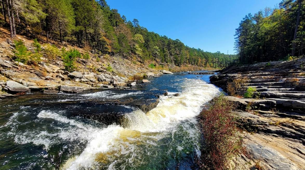
Cedar Creek Waterfall is our favorite “hidden” waterfall for guests who want a big payoff without a big hike. It sits in a quiet corner of northern Beavers Bend, near Cedar Creek Golf Course, and drops into a startlingly turquoise pool that photographers love.
- Round trip: About 0.8 miles (roughly 20 minutes each way)
- Difficulty: Easy
- Best for: Families, photography, quick post-lunch outings
- Trailhead reference: Cedar Creek Golf Course (see below)
To find it, drive toward Cedar Creek Golf Course. About a third of a mile before the course, look for a dirt road on the left labeled “Road 50900” on Google Maps. Park in the small lot and walk the dirt road. After about five minutes you will cross Cedar Creek. Shortly after, you will pass an ATV sign on the right. Turn left there. You will hear the water before you see it.
Because this trail is not officially signed, it stays pleasantly uncrowded even in peak season. Bring water shoes if you plan to wade into the pool.
Cedar Creek Golf Course
Not a waterfall itself, but the golf course is the landmark our guests use to orient themselves when they hunt for Cedar Creek Waterfall. It is also a fun midday break if you want to swap the hiking boots for a scorecard.
- Rating: 4.3 stars (153 Google reviews)
- Address: N US Hwy 259 N, Broken Bow, OK 74728
- Hours: 7 AM to 7 PM
- Phone: (580) 494-6456
- Category: Golf course
- Green fees: About $40 with cart on a recent Google review
Presbyterian Falls (Lower Mountain Fork River)
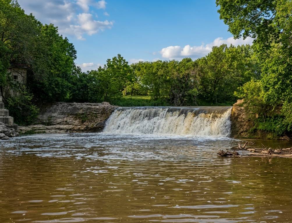
Presbyterian Falls is not a tall plunge. It is a distinct ledge drop, about five feet high, on the Lower Mountain Fork River, and it is one of the most photographed spots in Beavers Bend because kayakers routinely run it. In spring, when the river is high and the current is fast, watching a paddler drop over the ledge is its own kind of show.
- Best access: By kayak on a Lower Mountain Fork float trip
- Alternate access: Short informal paths down to the river bank
- Best season: Spring, when river releases from the dam are strongest
- Good for: Photography, paddling, cold-water fly fishing nearby
The river runs year round because it is fed by releases from Broken Bow Lake, but the “waterfall” character of Presbyterian depends heavily on flow. Ask any local outfitter for current release times before you plan a paddling day.
Mountain Fork River
The Lower Mountain Fork is the ribbon of cold, clear water that connects nearly every waterfall experience inside Beavers Bend. It is famous for its trout fishing, its kayak floats, and its riverside picnic spots.
- Rating: 4.9 stars (16 Google reviews)
- Address: 4905 OK-259A, Broken Bow, OK 74728
- Category: River, popular for fishing and paddling
- Best for: Kayaking to Presbyterian Falls, fly fishing, riverside photography
Ouachita National Forest Waterfalls: The Arkansas Day Trip
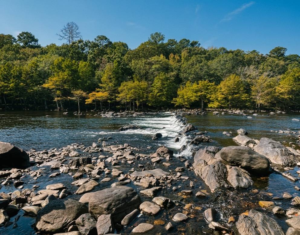
For guests staying with us at Three Creeks, the biggest waterfalls in the region are actually just across the state line in Arkansas. The Albert Pike Recreation Area and the Little Missouri River corridor sit about two hours east of Broken Bow. Leave the cabin early with a full thermos, and you can hit three or four cascades before dinner.
Albert Pike Recreation Area
Albert Pike is the launching pad for the Arkansas waterfall run. Once you park here, Blaylock Creek, Crooked Creek, and Little Missouri Falls are all within a reasonable drive on Forest Service roads.
- Rating: 4.7 stars (399 Google reviews)
- Address: Nfw 106, Umpire, AR 71971
- Phone: (870) 867-2101
- Website: US Forest Service Ouachita National Forest
- Category: Park (recreation area)
- Drive time from Broken Bow: About 2 hours east
Blaylock Creek Waterfall
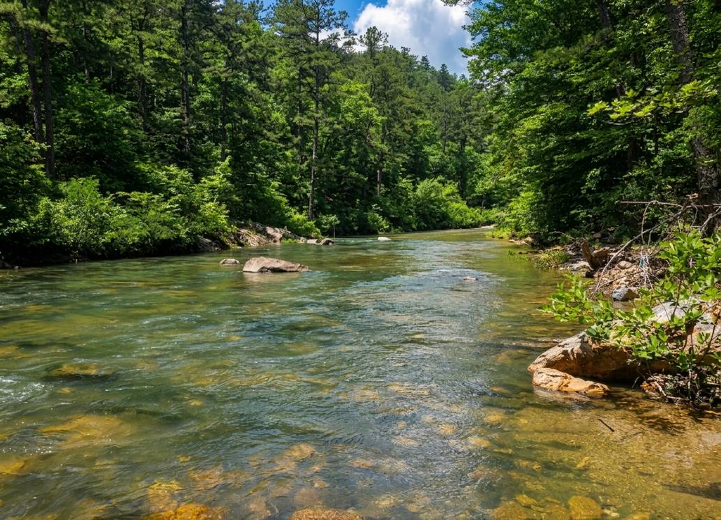
Blaylock is the workhorse of the Arkansas waterfall run: a scenic forest cascade at the end of a real hike, with almost no crowds most weekdays. It sits along the Winding Stairs Trail from the Blaylock Creek West Trailhead.
- Trail: Winding Stairs Trail, 4.8 miles out-and-back
- Waterfall location: First half of the hike
- Difficulty: Moderate
- Best season: Late winter through spring, after rain
- Drive from Broken Bow: About 2 hours east
If your group only has energy for one Arkansas waterfall, this is our pick. The forest is thick, the water is clear, and the trail is long enough to feel like a real accomplishment without wrecking the day.
Crooked Creek Falls
Crooked Creek is the quiet second stop after Blaylock. From the parking area, it is less than a mile of hiking, about 20 minutes on foot, to reach the falls. That short distance is exactly why we love pairing it with Blaylock and Little Missouri: three waterfalls, one drive, one very good day.
- Approach: Less than 1 mile from the parking area
- Difficulty: Easy to moderate
- Drive from Blaylock: A short additional drive
- Best paired with: Blaylock Creek Waterfall and Little Missouri Falls
Bring lunch. There are picnic-friendly rocks near the falls, and the cluster of Arkansas waterfalls is far enough from any real town that you will be grateful for the sandwich you packed at the cabin.
Little Missouri Falls
Little Missouri Falls is the postcard shot of the Ouachita National Forest. Crystal-clear water tumbles over layered rock formations into a series of turquoise pools, all within a short walk from the parking area. It is the kind of place where you set the camera down and just sit for a while.
- Rating: 4.8 stars (692 Google reviews)
- Address: AR-369, Langley, AR 71952
- Phone: (870) 867-2101
- Hours: Open 24 hours
- Category: Scenic spot
- Walk from parking: Less than a mile to the main viewpoint
A Northern Side Trip: Heavener Runestone Park
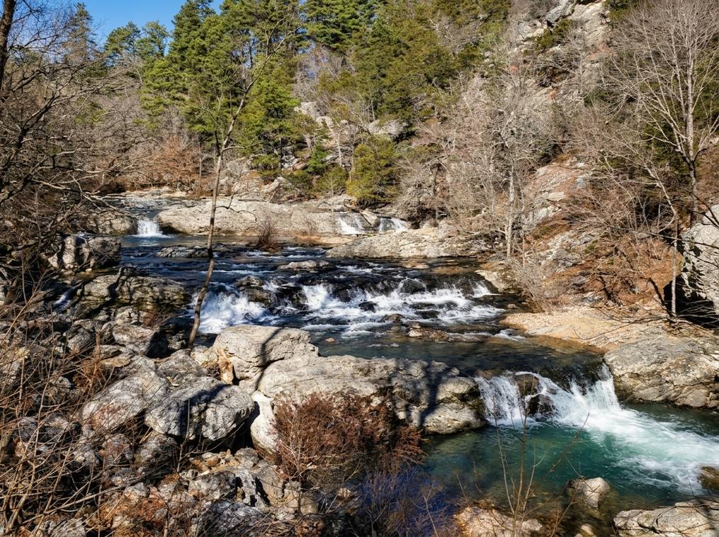
If you want a shorter drive and a little more history in your waterfall day, aim north instead of east. Heavener Runestone Park sits about a 90-minute to two-hour drive northwest of Broken Bow, in the foothills of the Ouachitas. Its waterfall is small, but the park pairs it with an unusual attraction: an eight-foot sandstone slab carved with markings that some historians attribute to Viking explorers.
- Rating: 4.7 stars (1,129 Google reviews)
- Address: 18365 Runestone Rd, Heavener, OK 74937
- Hours: 9 AM to 5 PM
- Phone: (918) 653-2241
- Website: heavenerrunestonepark.com
- Category: Park
- Waterfall trail: Runestone Loop, about 0.2 miles (dog-friendly)
Broken Bow Lake
Between waterfall stops, most guests want a lake break. Broken Bow Lake covers about 14,000 acres of clear water with 180 miles of pine-covered shoreline, and it is the reason so many visitors first fall in love with this corner of Oklahoma.
- Rating: 4.8 stars (314 Google reviews)
- Category: Lake
- Best for: Swimming, kayak paddling, sunset photography, cool-down after a hike
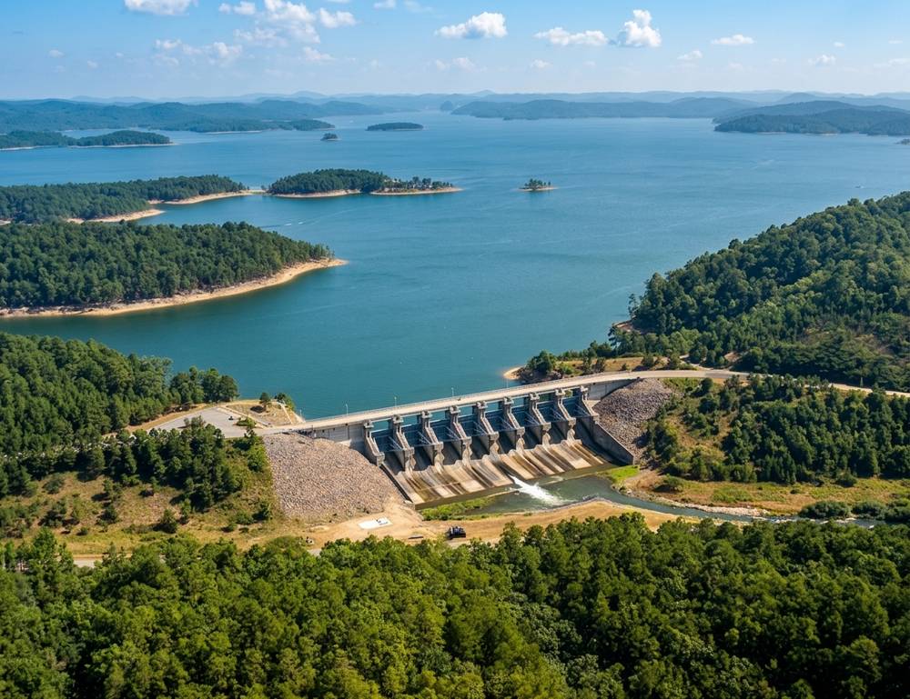
Even in peak summer, you can find a quiet cove for a swim after a hot Thunderbird hike. Water shoes help. So does a dry bag if you plan to bring a phone for photos.
How to Time Your Broken Bow Waterfall Trip

Waterfalls near Broken Bow are seasonal, and the difference between a “trickle” and a “roar” is usually a single rainstorm. Here is how our concierge team thinks about timing:
- Late winter through spring (March to early June): Peak flow across every waterfall on this list. Trails can be muddy, but the falls are at their most photogenic.
- Early summer: Still strong flow, longer daylight, warmer swim conditions. Our favorite window for families.
- Late summer: Flow drops fast in dry years. Presbyterian Falls still runs because it is fed by dam releases, but Thunderbird and Cedar Creek Falls may be modest.
- Fall: Water levels are lower, but the Ouachita hardwoods turn gold and red. Little Missouri Falls and Albert Pike Recreation Area are stunning in October.
- Winter: Trails are quiet, the pines feel enormous, and a rainy week can produce dramatic flow. Dress in layers.
The rain rule: If a serious storm passes through overnight, cancel your other plans and go the next morning. Local hikers call it “chasing the roar” for a reason.
Practical Tips Before You Hit the Trail
A few pieces of hard-won advice from our team and from guests who have hiked these trails in every season:
- Buy your parking permit at the visitor center first. Beavers Bend requires a parking pass at popular trailheads like Friends Trail and Skyline. QR codes are posted, but cell signal is unreliable, so pay in person before you drive to the trailhead.
- Download offline maps. Cell service is spotty across the entire park and nearly nonexistent in the Ouachita National Forest. Save your route in Google Maps or Gaia before you leave the cabin.
- Wear real trail shoes. Even the short walks (Cedar Creek, Runestone Loop) have wet rock, muddy tread, and roots. Skip the flip-flops.
- Pack water and salty snacks. Two liters per person minimum for the longer routes. Even the “easy” hikes get hot fast in summer.
- Watch for ticks, snakes, and slick ledges. These are wooded, riparian environments. Use insect repellent, check kids after hikes, and keep everyone off wet rock ledges.
- Fuel up in Broken Bow. Once you head east to Albert Pike, there are very few gas stations. Fill the tank before you leave town.
- Respect the flow. After heavy rain, low-water crossings on forest roads can become impassable. If you cannot see the road under the water, turn around.
A Two-Day Waterfall Itinerary from Three Creeks Reserve
If you have two full days and want to see as much water as possible, here is the plan we hand our guests:
Day 1: Close to home in Beavers Bend
- Morning: Coffee at the cabin, then drive to the Beavers Bend visitor center to grab a parking permit and current trail conditions.
- Mid-morning: Cedar Creek Waterfall via Road 50900. Easy 0.8-mile round-trip with a turquoise pool payoff.
- Lunch: Riverside picnic on the Lower Mountain Fork.
- Afternoon: Thunderbird Waterfall via the Boy Scout Road shortcut (or the full Skyline loop if you have the legs).
- Evening: Hot tub at the cabin. Watch the pines change color in the last light.
Day 2: Arkansas waterfalls day trip
- Early morning: Fuel up in Broken Bow, drive about two hours east to Albert Pike Recreation Area.
- Mid-morning: Blaylock Creek Waterfall via the Winding Stairs Trail.
- Lunch: Packed sandwich near Crooked Creek Falls.
- Early afternoon: Little Missouri Falls, one of the most photogenic waterfalls in the Ouachitas.
- Evening: Drive back to Three Creeks, pick up dinner in Hochatown, and rest.
If you have a third day, we send guests either north to Heavener Runestone Park or back to the lake for a slow paddle and a swim.
Ready to Chase the Roar?
Broken Bow’s waterfalls reward the guests who plan a little, watch the weather, and stay somewhere comfortable enough to shake off a long day on the trail. That is exactly what we do at Three Creeks Reserve: full-service cabins inside a curated woodland community, with a concierge team that knows every route in this guide.
If you are ready to trade the city noise for the sound of water on stone, book your Three Creeks cabin or reach out to our team with questions. We will help you time your trip to the rain and point you to the roar.
Frequently Asked Questions
Are there any waterfalls in Broken Bow?
Yes. The best-known named waterfalls inside the Broken Bow area are Thunderbird Waterfall on the Skyline Trail, Cedar Creek Waterfall near Cedar Creek Golf Course, and Presbyterian Falls on the Lower Mountain Fork River. All three sit inside Beavers Bend State Park. Local hikers also refer to a few informal cascades such as Whiskey Falls, though these are unofficial and locations are usually shared by word of mouth.
What is the biggest waterfall near Broken Bow?
For a truly dramatic drop, drive about two hours east into the Ouachita National Forest in Arkansas. Little Missouri Falls is the region’s postcard waterfall, with layered rock formations and turquoise pools. Blaylock Creek Waterfall on the Winding Stairs Trail is a close second and involves a more meaningful hike.
How difficult is the hike to Thunderbird Waterfall?
It depends on the route. The full Skyline Trail loop is about 8.6 miles and strenuous. A Cedar Bluff out-and-back gets you to the falls in roughly 4 to 5 miles round trip. The Boy Scout Road drive-in route reduces the walk to about 900 feet from the parking area, which is the family-friendly option.
When is the best time to see Broken Bow’s waterfalls?
Late winter through spring is peak flow across the region, especially after a heavy rain. Early summer is still strong and warm enough for swimming. In dry late summer, smaller waterfalls like Thunderbird and Cedar Creek can slow to a trickle, so watch the forecast and chase recent rain.
Do I need a permit to hike to the waterfalls in Beavers Bend?
Hiking itself is free, but Beavers Bend State Park requires a parking permit at popular trailheads including Friends Trail and Skyline. Buy the permit in person at the visitor center before you drive to the trailhead, since cell service is limited and the QR-code payment at the trailhead is unreliable.
Are the Broken Bow waterfalls kid-friendly?
Some of them are. Cedar Creek Waterfall (about 0.8 miles round trip) and the Runestone Loop at Heavener are excellent with young kids. Thunderbird via Boy Scout Road works for older kids ready for a short bushwhack. The full Skyline loop and the Winding Stairs Trail to Blaylock Creek are best for older kids and teens with real hiking experience.